

Directions to Trail:
Address:
Double Springs,Al
Directions:
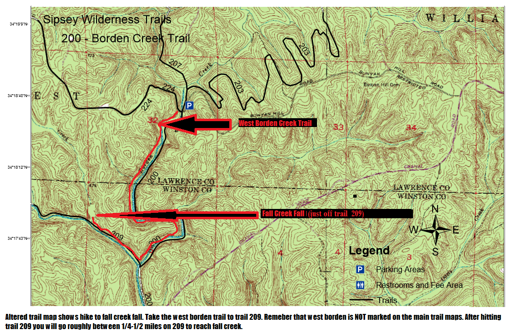
To the Fall Creek Fall hike:From Moulton, turn South onto highway 33. Travel about 13 miles until you reach road #6/Co.Rd 60.
Turn West on to Rd 6/ Co.Rd 60 and drive about 1/4 miles and you will see a sign directing you to the trail. You will
drive down a dirt road for a few miles to reach the parking area.
Trail head for the Fall Creek Fall hike:
To the Caney Creek hike:From Moulton, turn South onto highway 33. Travel about south until you reach road #2/Co.Rd 2.
Turn West on to Rd 2/ Co.Rd 2 and drive about 3.5 miles or so and you will see a sign along the north side of the road.