
Cane Creek Nature Preserve Trail
 |
 |
 |
 |
Intro:
Cane Creek gets a ranking of #3 on my favorites list. It is one the most awesome hikes you can do in Northwest Alabama. It is located about 10 miles south of the city of Tuscumbia.
Cane Creek Preserve was originally owned by Jim and Faye Lacefield. The couple purchased the property several years ago and opened it to the public. The Preserve is now owned and maintained by The Land Trust of North Alabama. There are 25.7 miles of scenic hiking trails throughout the preserve.
Hours are Friday - Sunday 7:00 a.m. to 5:00 p.m. Open on all holidays except Thanksgiving and Christmas
NOTE: YOU MUST SIGN IN BEFORE YOU BEGIN YOUR HIKE AT THE KIOSK NEAR THE PARKING AREA!!!
Trail Head:
The main trail head is located on the Lacefields property.
Difficulty:
I rate this a "Medium" because of a few areas. There are some steep hills. Most of the area provides an easy hike but you may run into some areas where the footing can be tricky. It is a nice safe place to hike!
Hiking the Trail:
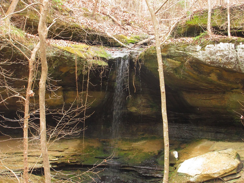
To get the best views and most enjoyable experience I suggest simply following the trail signs to the waterfall to start.
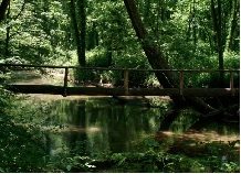
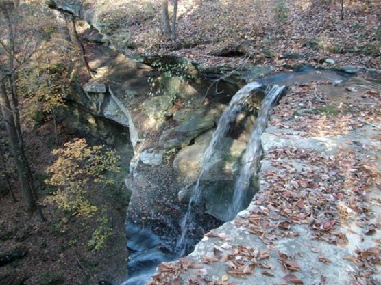
After a short hike from the trail head you will reach a beautiful waterfall. After you have taken in the scenery at
the falls, cross over the foot bridge and continue up the trail. After another short hike up the ridge point trail, you will reach the camping
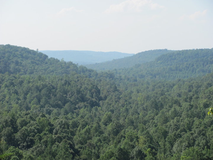
area. Once you reach the camping area just walk towards the north and there you will reach on overlook called "The Point". This overlook may
very well be the best view in all of Northwest Alabama, because it gives you a breathtaking view of the canyon. From there
you should take the trail down to cane creek. On the way down to the creek you will pass the tree fern cave, which
is a beautiful rock shelf just to your right as you're taking the trail down to the creek.
I like to stay on the east side of the creek and hike along side of it via the east cane creek trail. There are other trails you may choose to hike from that point on.
You cant go wrong with any of them. I suggest arriving early, pack some snacks and plenty of water, and pick which ever trail you choose after reaching the creek. The Lacefields have
a map you can borrow to take along with you, and if you get a chance, you may want to speak with them about where to go.
They will tell you what particular part of the preserve would make for the best hike the day you are there. Remember, there are over
25.7 miles of trails so which ever direction you go will be well worth it!
GPS Coordinates:
Cane Creek Preserve main parking (South end of preserve, sign in here):
N 34°37.333' W 087°47.663'
Scenic Overlook #2 (north end of preserve):
N 34°38.061' W 087°49.026'
Northwest Falls Rim trail:
N 34°38.456' W 087°48.479'
Scenery:
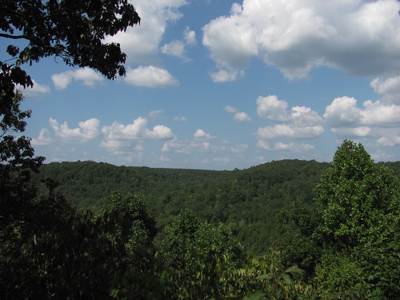
Cane Creek offers the best scenery of any trail in Northwest Alabama. A beautiful waterfall will greet you at the beginning of your hike. You will get an awesome view when you look over the canyon at "The Point" close to the camping area. There is creek along side part of the trail that offers an incredible view as well. On the north end you can get great views of Devils Hollow and there is also a nice overlook on that end as well. Large bluffs, wildlife, and scenic views of hollows can also be seen along your hike.
Trail Maintenance:
The Land Trust does an excellent job of maintaining the trails. They are clean, safe trails. They even have stations for you to refill your water!
Facilities:
The trail has 3 camping areas for tents. Its a short hike from the parking area to the small point camp area. There is another camp area near "the point" and another near linden meadows. You must contact the Landtrust before your trip and ask their permission to camp (which they will most likely grant you). They just need to know before hand simply for safety reasons. Alcohol is not allowed in the camping area. There is also a few porta potties in these areas. Some are located at the camping areas. The Landtrust will usually provide water refill stations (I suggest packing plenty to start with no matter which trail you are on).