

 |
 |
 |
 |
Intro:
South Cumberland State Park has several locations to hike, spread out among four counties in the southern Tennessee area. Savage Gulf, Grundy Forest area, and
Foster Falls are a few of those areas.
Trail Head:
There are several different trail head locations.
To access the trail head: It's best to go to the SCSP visitors center and pick a map that has all the trail locations.
Difficulty:
Some of the trails are easy while some of them can be difficult. As far as the ones I hiked I would rate them medium. The hike down the the base of Foster Falls is real steep and rocky, there is also some rocky areas along the Grundy Forest area.
Hiking the Trail:
For this hike I chose the Grundy Forest area, part of the Fiery Gizzard trail, and Forest Falls.
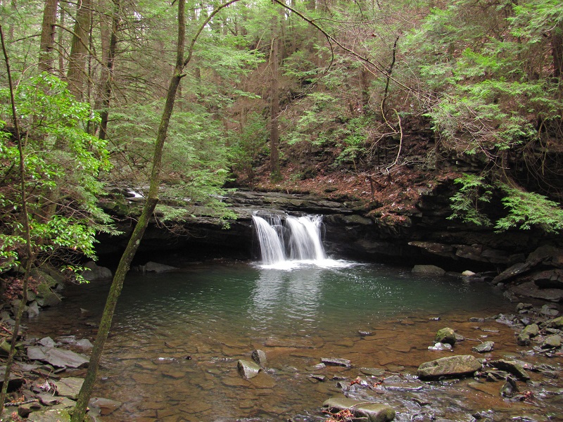
Grundy Forest/Fiery Grizzard: For this loop I began at the trail entrance near the information kiosk (you can also begin at the entrance behind the
restrooms). Since it loops back to the same parking area it really does not matter. As you hike the Grundy Day Loop you will spend most of you hike along a couple of very scenic
mountain streams. Near the halfway point is a wooden footbridge that will take you over to the other side of the stream and onto the Fiery Grizzard trail. This trail itself is over
13 miles in length so due to lack of time I only hiked a short section of it before returning back and finishing the Grundy Day Loop. The Fiery Grizzard Trail starts at the
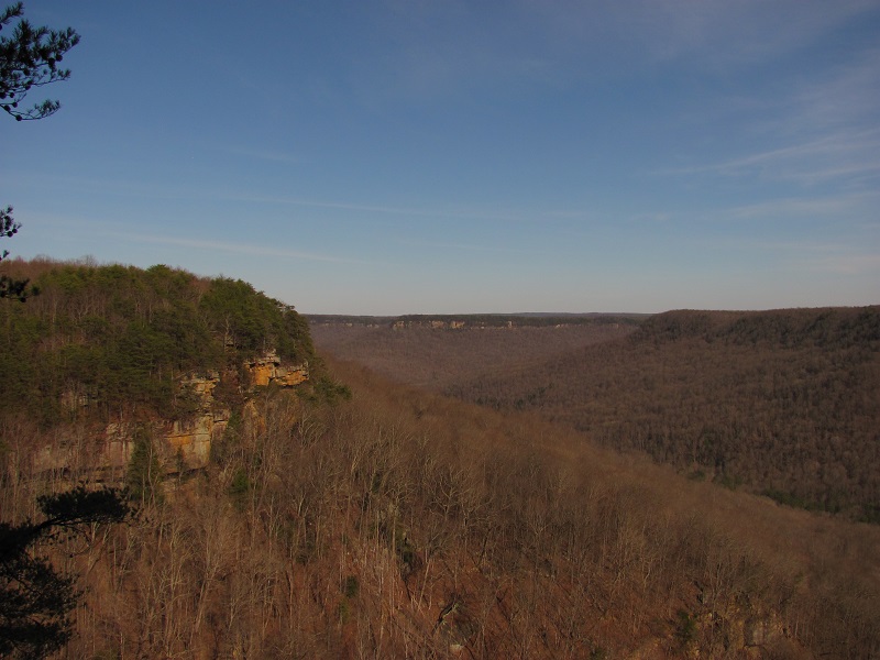
Grundy Day Loop trail and goes all the way to Foster Falls. There is a scenic overlook along the Fiery Grizzard trail along with a scenic stream and a few waterfalls. After finishing
the Grundy Day Loop I suggest driving over to the Foster Falls trail head.
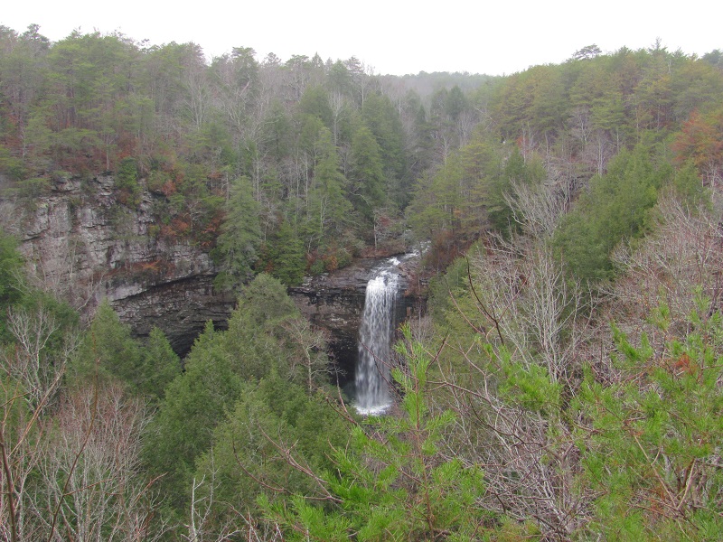
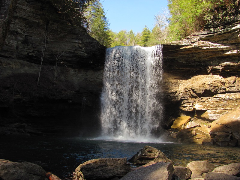
Foster Falls: From the parking area you hike about 125 yards across a board walk and from there you can overlook the waterfall from above.
You can then hike to the bottom of the falls. Just follow the signs. It's only about 1/4 mile down to falls (if that far), however it's pretty steep and rocky so be careful.
There are many other trails to choose from at South Cumberland State Park. I plan on going back and covering more of them at some point.
For this hike I chose part of the Savage Gulf Natural Area.
Savage Gulf State Natural Area: The Savage Gulf State Natural Area, located in Beersheba Springs, TN, has some incredibly scenic hikes. It features
three scenic waterfalls, the "stone door", and some scenic overlooks from atop the mountain. One way to hike this is to park at the Stone Door ranger station and do a two mile round trip
hike out to the stone door overlook and the short hike to Laural Falls (just a few hundred feet from the ranger station). You will need to sign in here at the ranger station. If you want to hike
to greeter falls and boardtree falls you can park at the greeter falls parking area. It's about a 1.6 mile round trip to greeter and if you hike on to boardtree falls (which i suggest) it's about
a two mile round trip. These two hikes are only a small part of Savage Gulf, but hiking them this way will give you a good 4 mile hike seeing some great waterfalls and overlooks. you can also hike
from greeter falls to the stone door and vice versa but it will be a long one. I did not do it that way since my purpose of going there was to gather information for the website.
Savage Falls:Another good hike to do here is to take the Savage Day Loop to Savage Falls. A good way to hike this is to park at the Savage Gulf Ranger Station and head out from there. From
the trail head it's about 1.5 miles to the falls and it's a pretty easy hike. You will be able to follow signs to the falls. Once you have visited the falls you can
finish the Savage Day Loop and get in a good four mile round trip. If you need more info go to the
South Cumberland State Park website
Collins West: The Collins West trail head is a great place to park if you want to hike out to Suter Falls and Horse Pond Falls. Less than 1/4 into your hike
you will reach a sign direction to the Collins West Overlook, and to the waterfalls. I suggest doing the short hike out to the overlook and then getting back on the trail and beginning
your hike to the waterfalls. Suter Falls is not that far out from the trail head. It's a really nice waterfall. From Suter Falls you will continue on to Horse Pond Falls. Horse Pond Falls is
just over 2.5 miles from the main trail head, so a hike from the Collins West parking area to Suter Falls and then to Horse Pond is just over a 5 mile round trip. The hike between Suter and Horse Pond Falls
has some rocky terrain that can affect your footing so it will slow you down and bit.
GPS Coorinates:
Collins West trail head:
N 35°24.396' W 085°35.599'
Suter Falls:
N 35°24.664' W 085°35.855'
Horse Pond Falls:
N 35°25.721' W 085°36.165'
Scenery:
Here you will see mountain streams, waterfalls, overlooks and more.
Trail Maintenance:
The trails are well maintained
Facilities:
Each trail head has a restroom. You can also camp (with a permit).