
Sewanee University Trails
 |
 |
 |
 |
Intro:
Sewanee University, also known as the "University of the South", sits on a 13,000 acre campus in the Cumberland Plateau. Sewanee's 30 plus miles of trails will take you to scenic overlooks, waterfalls, bluffs, and you will also get to see one of the most beautiful college campuses in the south east. A book about how to hike the Sewanee trails is available in the Sewanee University book store.
Trail Head:
There are different trail heads here. Some are located at the university gates, while others are located further into the campus.
To access the trail head: Trail head locations are available on the map.
Difficulty:
Some parts of the trail are easy while others can be more difficult.
Hiking the Trail:
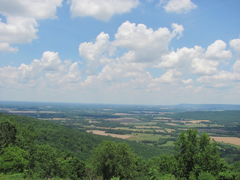
For my hike I began at the Green View trail head and hiked the Bethswick trail. Starting at the the Green View trail head you will
begin your hike with an awesome view via the overlook. You can then make your way to the trail and begin hiking the Bethswick trail.
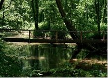
You won't go far before you see two wooden footbridges. For my hike I stayed to the right and continued on the Bethswick trail. From here
I hiked about four tenths of a mile until reaching Bethswicks Point. After that I continued on. You won't go to far before reaching the edge of the golf course.
Follow the trail around the edge of the course and then back into the woods. The trail will go all the way to the university gates. After reaching the gates I
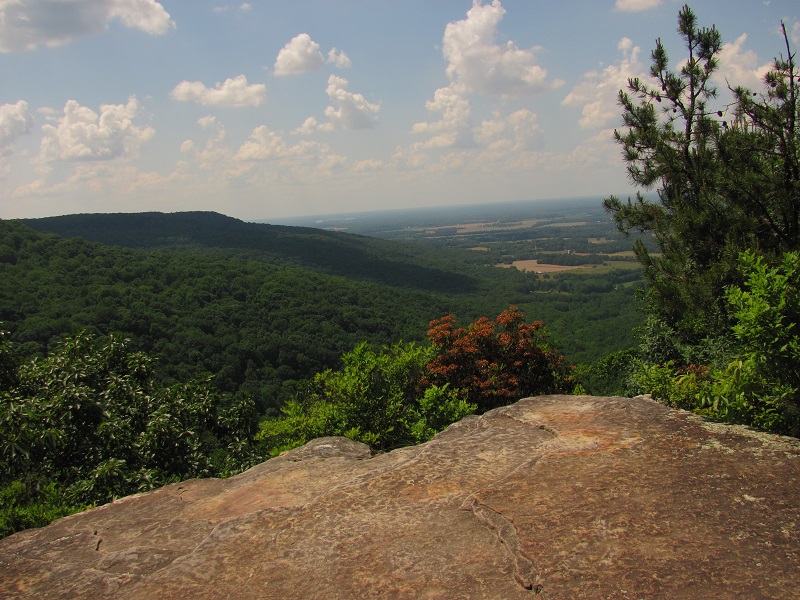
connected to the Piney Point trail. The Piney Point trail is 1 mile out and back that starts near the university gates. It's well worth adding this to your hike since
it takes you to an incredibly scenic overlook. After hiking the Piney Point trail I made my way back to the Green View trail head via the Perimeter trail.
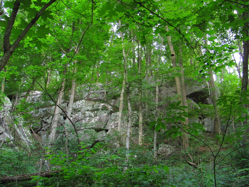
This part of the Parameter trail takes you below the bluffs and back to the Green View trail head. After about a mile and a half you will see a sign
pointing you back to the Green View trail head. Be careful right here as you have to do a bit of climbing up the rocks (not much) to get back to the
trail head.
Note: There are several more loops to do at Sewanee. The one I covered is about a 5.5 mile round trip and very scenic. There are other
loops and trails that take you to more overlooks, waterfalls, etc. So study which ones you would like to try out and go for it. Sewanee University is a
beautiful place.
Bridal Veil Falls hike: Another good hike I knocked out was the hike to Bridal Veil Falls. It's not to long and a great hike to do in the winter.
You can begin at Morgan's Steep. From the starting point at Morgan's Steep take the Perimeter trail over to the Bridal Veil Falls trail. The Bridal Veil Falls trail should only be about
0.2 miles from Morgan's Steep. From here you will cross over a wooden foot bridge that has a mountain stream flowing underneath. You can then follow the Bridal Veil Falls trail to the waterfall.
It's about one mile from Morgan's Steep to the waterfall. So a nice two mile out and back round trip. Bridal Veil Falls flows from the bluff down into a large sink hole. It's very scenic.
After viewing the waterfall you have a few options. You can take the exact same trail back, or complete what is called the Arcadian loop (you will need to purchase the book "Go Take a Hike" from the Sewanee book store to see what this is). For us, we
hiked on down into the hollow below the fall (be careful if you do this), and then hiked our way back to Morgan's Steep. It's a great short hike, good to do in the winter during
watefall season.
Sewanee Natural Bridge: Located about 2.3 miles south of Sewanee on Hwy 56 is the Sewanee Natural Bridge. It's not a hike since it's only about
100 yards from the parking lot, however, it's worth a trip to see.
Buggy Top Cave Trail: Located about seven miles south of Sewanee on Hwy 56 is the Buggy Top Trail. You will see the parking area on the left side of
the road. There is a sign there that says "wildlife viewing area" just before you reach the parking lot (there is no sign on the road to let you know it's the Buggy Top trail).
The trail to Buggy Top is a two mile out and back trail, so a four mile round trip. Just hike the two miles until you reach a sign pointing you to the bottom of the cove
that will take you to the cave entrace (The cave is closed certain times of the year). After hiking to the cave entrance you can hike back to the main trail and then hike a little
further up to get a great view from an overlook. The hike is worth it since it's such a large cave opening and it also has a river flowing out of it.
Scenery:
The Sewanee University trails offer you scenic overlooks from atop the mountain, waterfalls, large bluffs, etc.
Trail Maintenance:
The trails are well marked with signs and they are well maintained
Facilities:
Before you park there are a few places on campus with restrooms. There is also a nice restaurant called Shenanigans you may want to check out. The town of Cowen, Tn is nearby and they have gas stations.