
TVA Rockpile Trail
 |
 |
 |
 |
Intro:
The TVA Rockpile Trail comes in at #5 in my top five favorite list. It is a 2.7 mile out and back trail.
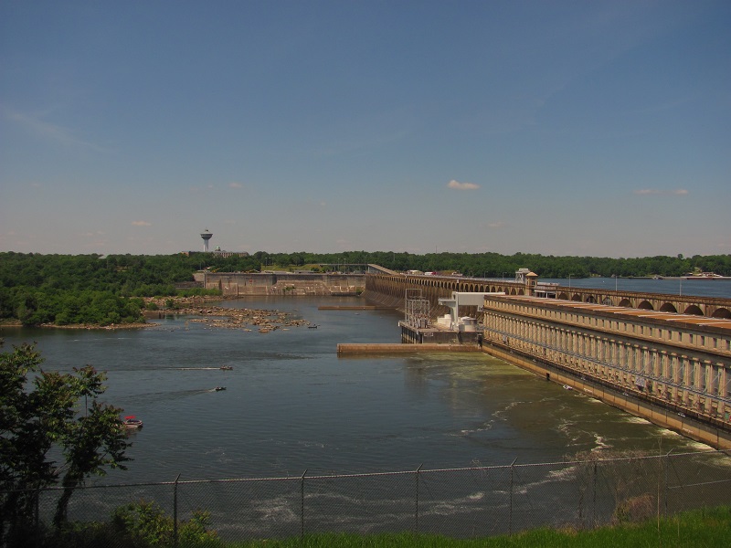
It will take you on an incredible hike between Wilson Dam and O'neal bridge, giving you breath taking views
of the Tennessee River on Wilson Lake. The TVA Reservation also has loop trails on the West side of the Rockpile trail
that are nice as well. I will also be discussing them.
Trail Head:
There are two main trail heads for the Rockpile. One is located at the Rockpile recreation area.
The western trail head is located where the other TVA Nature trails are located.
To access the trail heads: To get to the Rockpile area, as you cross Wilson Dam continue on Reservation Road for a few miles, you will see a sign on the right
pointing you to the Rockpile area. To access the west trailheads continue west on Reservation Road, there you will see a sign directing you to the nature trails.
area.
Difficulty:
I rate this a "medium" for the simple reasons that there are some areas of incredibly steep hills and steps. Some areas of the steps you will need to just be careful and watch your footing. This trail can take a lot of energy out of you because of the terrain. You may encounter a few places where the grass is slightly tall, so as you are walking through here just watch for snakes (although I have never seen any).
Hiking the Trails:
Rockpile: You can start at the Rockpile Recreation area. The trail head at the Wilson Dam overlook is closed now due to safety reasons. From the Rockpile area you
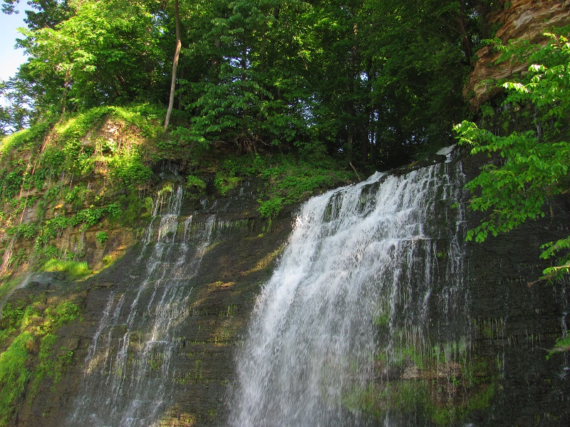
can head west to begin the Rockpile Trail. You can also head east on the Energy Trail, but keep in mind it is closed before you reach the waterfall.
I suggest you take photos, and take in the scenery, on the "out" part of your trip, because you will need
to use the "back" part of your trip for just hiking back to your vehicle. If you do not want to hike "out and back" you can ask someone to go with you
and park their car at one trail head, then ya'll can drive to the other trail head and hike to the other car, that way you will only have to
hike 2.7 miles out and not back. You have to remember, it's 2.7 one way, so if you go by yourself, or if your group takes just one car, you
will hike "out and back" for 5.4 miles. It's pretty simple from here. just hike out, and hike back (if thats how you want to). Along the trail
you will be hiking along side the Tennessee River. After a bit of hiking you will come to the road that goes down to the
boat ramp, just exit the trail, head north down that road (towards the river), and just to your left the trail will continue.
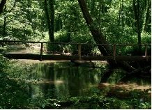
After another good bit of hiking you will come to another spot where the trail is split. This spot is Patton Island Bridge
(or singing river bridge now). To cross just walk underneath the south side of the bridge and you will see a walkway. Just take the
walkway under the bridge and continue up a hill and you will be back in the woods on the trial. After this you will eventually
end up at the "skimmer wall". Its just a concrete skimmer wall in the water that has a walkway (with rails) on the top. It is a great point
to stop and take photos of the river, The Renaissance Tower, or Patton Island Brige. Close to the end you will get to an old pavilion that will give you an awesome view
and a place to rest if needed. Their is also a restroom there. Your hike will end at the location where other TVA nature trails are located.
NOTE: For now you can no longer hike the section of the Rockpile trail above the waterfall (at the Wilson Dam overlook) due to safety reasons. You can access the Rockpile trail from the Rockpile Recreation area.
As of December of 2015 their have been improvements on the South Port trail and other trails on this end of the TVA trail system. The
South Port trail has been cleared in some areas so you can walk through and see better. New improved maps and signs have also been added to give you more information
on each trail.
South Port: The South Port Trail is pretty short. It is more for history buffs of this area. South Port was the largest
cotton industry town this side of the Mississippi River. However,during the civil war, Union gun boats shelled the town until nothing was left.
From the road way you can actually see the
remnants of the small earthened forts built by the Confederate Army in 1864. The CSA Army dug in here for a few weeks until the river was crossable.
There are a few small historical markers worth looking at on the walkable part of the trail that will tell you about the civil war history and
the history of the town of South Port. You may also like to check out the other loops through there as well.
GPS Coordinates:
Nature Trail trail head parking:
N 34°46.803' W 087°39.418'
Skimmer Wall (Old Wilson Steam Plant Site):
N 34°47.231' W 087°39.001'
Old Rail Road Train Bridge:
N 34°46.832' W 087°40.058'
Pond Creek:
N 34°47.339' W 087°38.624'
Rockpile Recreation Area:
N 34°47.502' W 087°38.190'
Scenery:
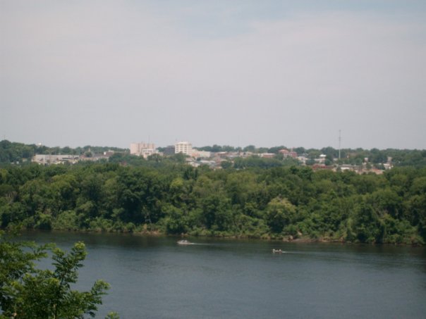
On the Rockpile trail you will get incredible views of Wilson Dam, Singing River Bridge, O'neal Bridge, The Renaissance Tower, and a good view of down town Florence,Al. Your whole hike will be full of great views of the Tennessee River. A beautiful waterfall will greet you at the Wilson Dam trail head, and you will see some rocks, creeks, and some wildlife along the way. On the South Port Trail you will see earthened forts from the civil war era, and some historical markers.
Trail Maintenance:
The Rockpile trail is fairly well maintained. You will come across some areas that will have open fields. Sometimes you will encounter high grass along the side of the trail in these areas. Other than that it's fairly maintained. The South Port Trail has recently been worked on and improved.
Facilities:
There are some camping areas if I recall. On the West trail head there is a parking area that has a bathroom facility, maps of the trails, e.t.c. There is also a pavilion near the West trail head (maybe 1/4 mile from there anyway) that has picnic tables and a bathroom.